

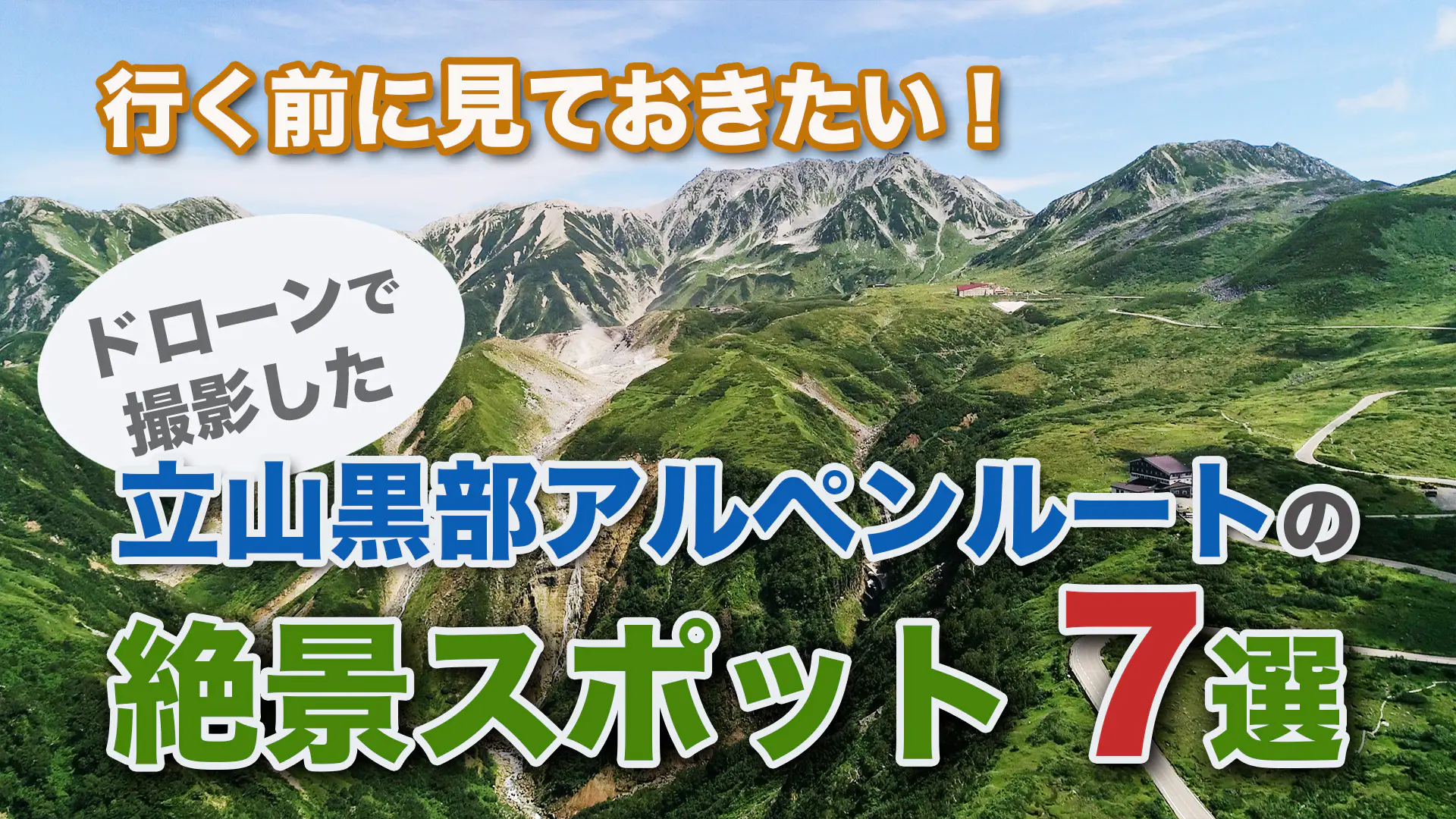
行く前に見ておきたい!立山黒部アルペンルートの絶景スポット7選
7 supectacular views to see before visiting the Tateyama Kurobe Alpine Route.
日本を代表する山岳観光ルート、立山黒部アルペンルート。
その醍醐味は、まさにここでしか見られない大パノラマの絶景にあります。
標高3000m級の峰々が連なる立山連峰には、登山家の憧れである剱岳や日帰りで登山を楽しめる主峰の雄山が、そのふもとには、気軽に散策できる室堂平周辺や弥陀ヶ原など、人気の観光スポットが広がっています。
本格的な登山を楽しみたい人から、軽装で自然を満喫したい人まで、誰もが満足できる山岳観光地なのです。
しかし、せっかくケーブルカーやロープウェイを乗り継いで到着したのに、「なんにも見えなかった!」という経験をした人も少なくないでしょう。立山黒部アルペンルートは手つかずの大自然が広がっている一方、世界屈指の豪雪豪雨地帯であり、年間降水量は雪と雨を合わせて約6000mmにもおよびます。
そこで、今回は天気のよい日に立山黒部アルペンルートをドローンで撮影した四季折々の絶景映像を厳選してご紹介します。
これから立山に行きたいと思っている方は、できるだけ効率よく登山や散策を楽しむためにも、立山のどこに行けばどんな大パノラマ絶景が楽しめるのか、ここでチェックしてみてください。そうじゃない方もドローンがとらえた壮大な大自然の風景に酔いしれ、観光気分を味わってくださいね。
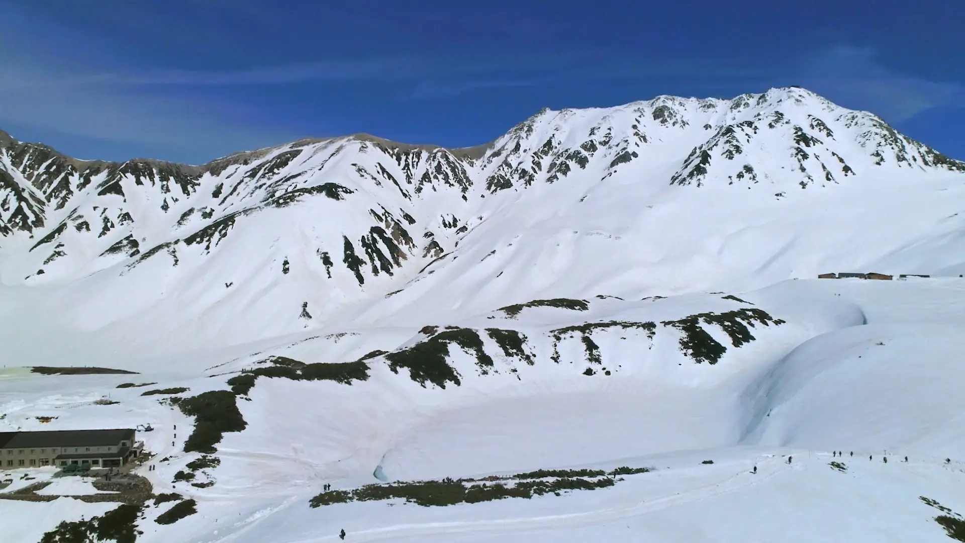
The Tateyama Kurobe Alpine Route is one of Japan's leading mountain sightseeing routes. The real thrill lies in the large panoramic view -zekkei- that can only be seen here.
In the Tateyama Mountain Range, which has a series of peaks with an altitude of 3,000m, Mt. Tsurugi, which is the dream of climbers, and Mt. Oyama, the main peak of Tateyama, which can be enjoyed on a day trip , with a wide variety of attractions. From those who want to enjoy full-scale mountain climbing to those who want to enjoy nature in light clothing, it is a mountain sightseeing spot that everyone can be satisfied with.
However, there are probably more than a few people who have come all the way here and have had the experience of "I couldn't see anything!". While the Tateyama Kurobe Alpine Route is surrounded by untouched nature, it is also one of the world's most heavy snowfall and rainfall areas, with an annual rainfall of about 6,000mm, including snow and rain.
Therefore, this time, we will introduce carefully selected particularly wonderful video footage of the Tateyama Kurobe Alpine Route taken with a drone on a sunny day.
If you are thinking of going to Mt. Tateyama, please check here to find out where to go and how beautiful it is. Even if you are not, I hope you will be intoxicated by the magnificent natural scenery captured by the drone and enjoy the feeling of sightseeing.
1. 高さ20mの雪の壁「雪の大谷」
富山地方鉄道の立山駅から、ケーブルカーと高原バスに乗り、およそ1時間。標高2450mの立山室堂平に到着する直前にあるのが、立山の雪深さを象徴する「雪の大谷」です。
両側から迫ってくるような雪の壁は、雪が多い年には高さ20mにもなります。
毎年4月15日ごろに富山県と長野県を結ぶ山岳観光ルートの立山黒部アルペンルートの全線が開通し、それから6月ごろまで雪の大谷を歩いて大自然の神秘を楽しめるイベント「雪の大谷ウォーク」が開催されます。
2012年、世界屈指の豪雪地帯として知られる立山連峰の万年雪の一部が、それまで日本にはないとされてきた「氷河」であることが発見されました。北半球に存在する氷河の南限が立山なのです。
立山の雪解け水は1年中枯れることなく、富山の大地を潤しています。
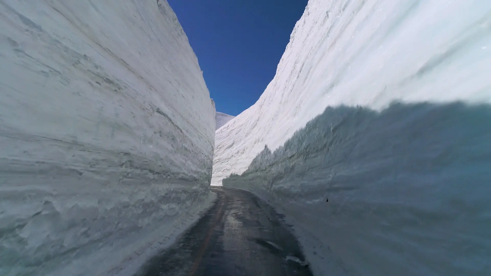
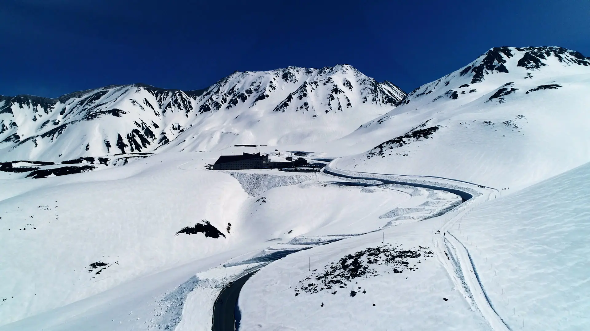
From Tateyama Station on the Toyama Chiho Railway, take the cable car or Kogen Bus for about one hour. Just before arriving at Tateyama Murododaira, 2450 meters above sea level, you will find "Snow Wall", which symbolizes the depth of snow in Tateyama. The walls of snow that seem to be coming at you from both sides can be as high as 20 meters in years when there is a lot of snow.
Every year around April 15, the Tateyama Kurobe Alpine Route, a mountain tourism route connecting Toyama and Nagano prefectures, opens to traffic, and from then until around June, the "Snow Wall Walking" event is held to walk through there and enjoy the mystery of nature.
2. ライチョウに出会える「室堂平周辺(みくりが池、地獄谷)」
日本一標高の高いところにある駅、室堂ターミナルから綺麗に整備された遊歩道を歩いていくと、人気の観光スポットみくりが池があります。
立山黒部アルペンルートが全線開通する4月から5月にかけての季節は湖面が厚い雪で覆われ、徐々にその姿を変えながら、夏には青く澄んだ湖面が現れます。
外周約630m、水深約15mの みくりが池は、約1万年前にできた火山湖です。
風の穏やかな日には紺碧の湖面に、立山の主峰である雄山(標高3003m)をはじめとする雄大な山々が映し出され、まさに息をのむ絶景となります。
みくりが池の周囲に茂るハイマツは、特別天然記念物のライチョウが多数生息しています。7月から8月にかけて、運がよければ親鳥のあとをついて歩くかわいいヒナを見られるのもこの辺りです。
悪天候で視界のよくない時ほど、ライチョウに出会えるチャンスが高まります。
湖畔の遊歩道を進むと硫黄の匂いがたちこめ、立山信仰の象徴「地獄谷」が見えてきます。
荒涼とした風景と吹き上がる火山ガスが、異世界を感じさせます。
晴れた時は景観を楽しみながら、視界の悪い時はライチョウを探しながら。みくりが池の外周をゆっくりと1周しても、1時間かかりませんので、超オススメの散策コースです。
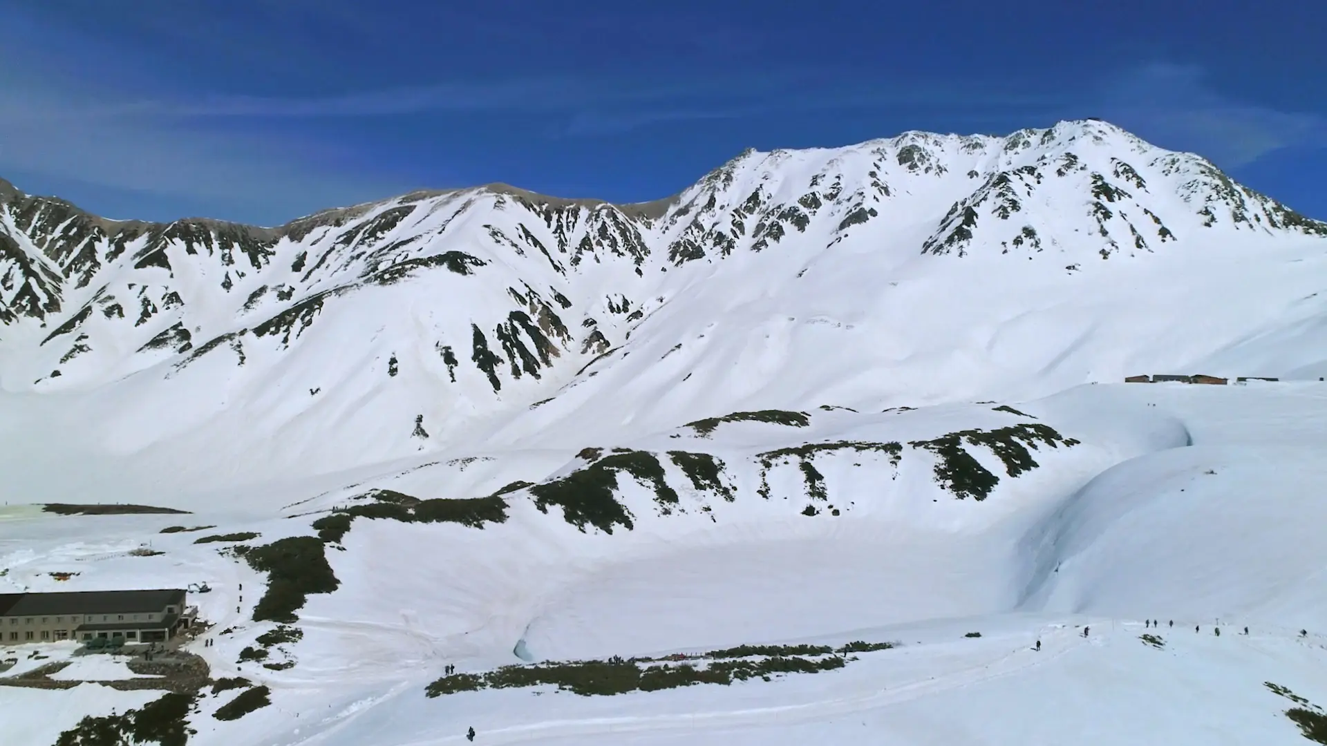
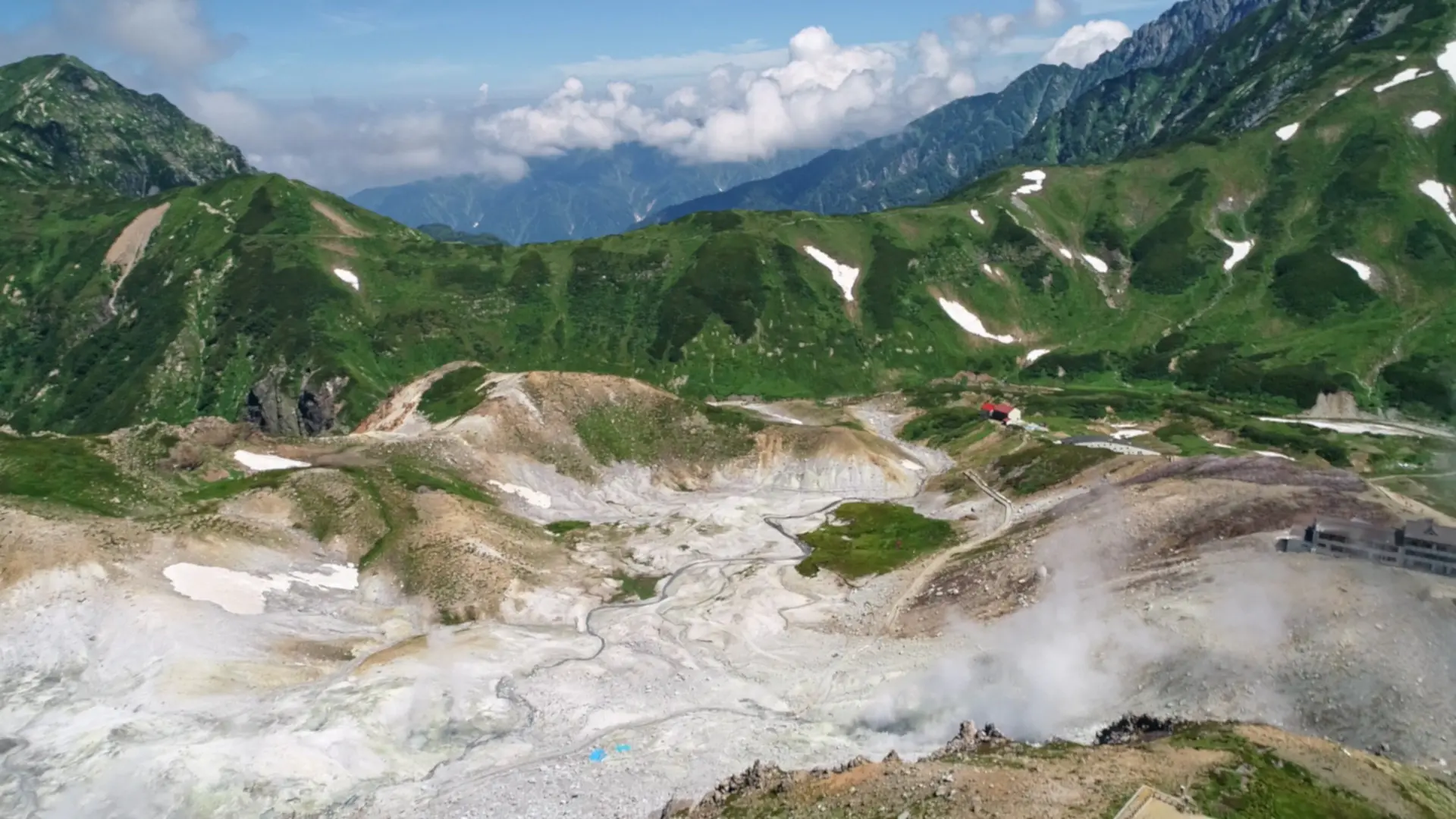
Walking along a beautifully maintained promenade from Murodo Terminal, the highest station in Japan, you will find the Mikurigaike, a popular tourist spot. In spring, the surface of the lake is covered with thick snow, gradually changing its appearance to reveal a clear blue lake in summer.
The pine trees surrounding the Mikurigaike offer the best chance of spotting grouse, which are a special natural monument of Japan.
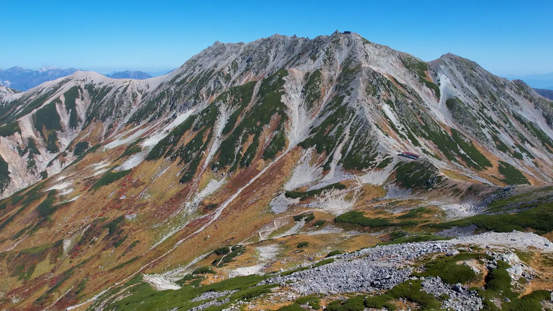
3. 2時間で3000mからの大パノラマ「雄山山頂」
立山で最もポピュラーな登山コースが、室堂ターミナルから一の越を経由し、雄山山頂を目指すコースです。
健康な人なら2時間ほどで登頂、4〜5時間あれば往復できる登山初心者向けのコースですが、山頂には息をのむほど美しい、360度の大パノラマ絶景が広がっています。
富士山・白山と並ぶ日本3霊山のひとつ立山は、古くから信仰の山として登拝されてきました。
立山は雄山(標高3003m)・大汝山(3015m)・富士ノ折立(2999m)からなり、日本百名山に選定されています。
雄山山頂には、雄山神社峰本社が祀られ、参拝料を納めるとお祓いを受けることができます。登頂の達成感と共に霊験あらたかな気分を味わえます。
山頂の眼下には室堂平が広がり、天気のいい日には富山湾・能登半島まで一望できます。逆側には後立山連峰や北アルプスの名だたる名峰、そして運がよければ遠くに富士山を拝むこともできます。まさに360度の大パノラマで絶景が広がっています。
富山県では高学年になると立山登山を行う小学校も多く、それだけ初心者にもオススメの登山コースであると言えます。
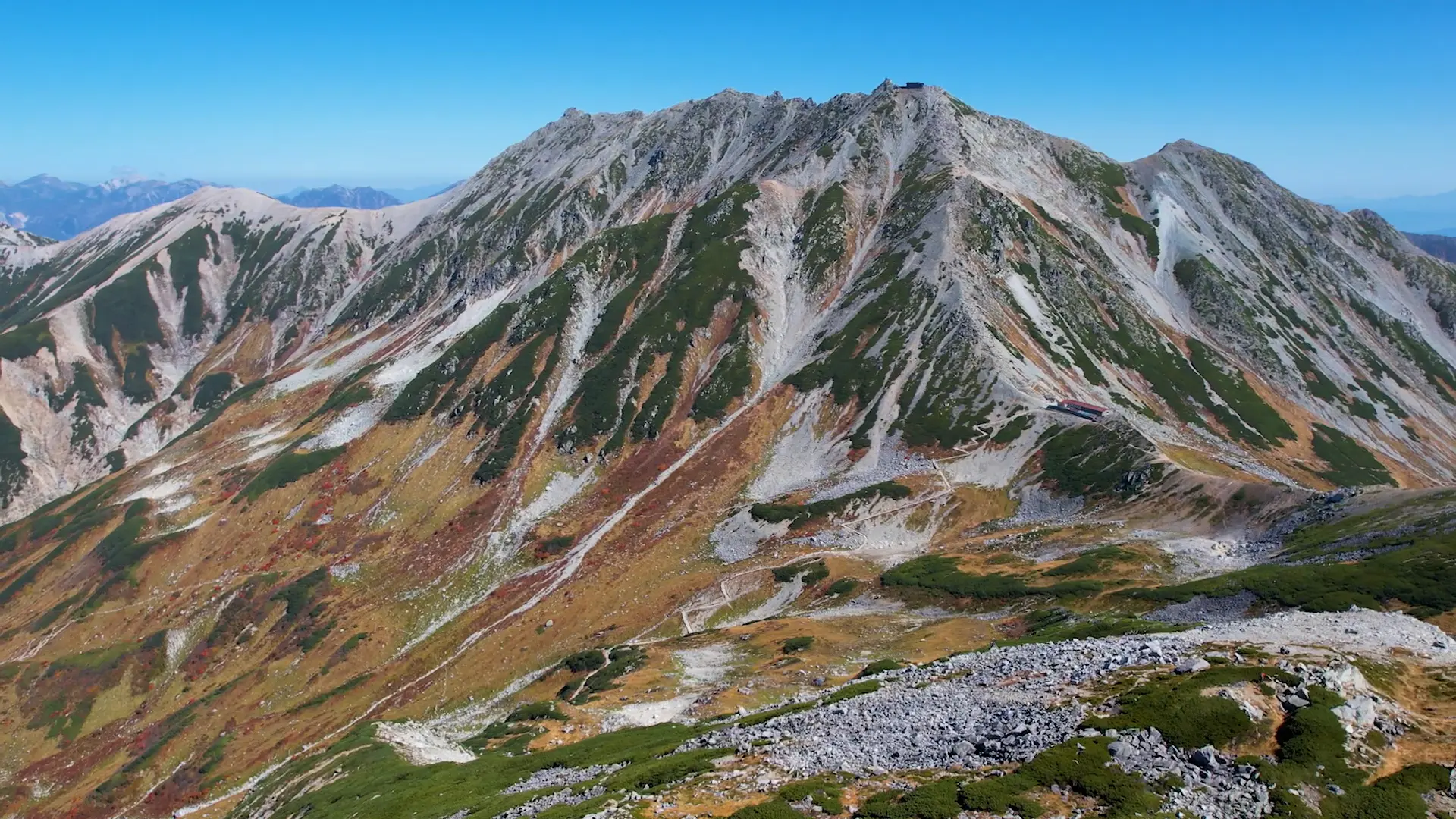
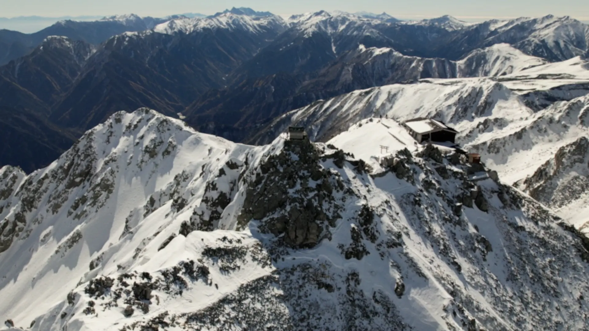
Mt. Tateyama, one of Japan's three sacred mountains along with Mt. Fuji and Mt. Hakusan, has long been worshipped as a mountain of God. On the summit of Tateyama's main peak, the Oyama Shrine is enshrined, and visitors can feel a sense of accomplishment from the ascent, as well as a sense of spirituality.
On a clear day, the summit commands a panoramic view of Toyama Bay and the Noto Peninsula. On the other side, you can see the famous peaks of the Ushiro-Tateyama mountain range and the Northern Alps, and if you are lucky, Mt. Fuji in the distance.
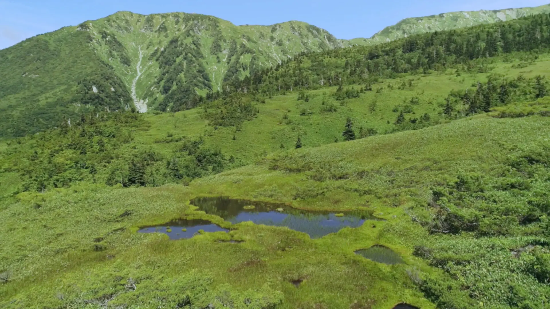
4. 木道で異世界の大湿原を散策「弥陀ヶ原」
美女平から高原バスで室堂に向かう途中にある弥陀ヶ原は、立山の水の豊かさを象徴するスポットです。
標高1600mから2000mにかけて、東西4km・南北2kmmに渡るこの広大な湿原は、日本で最も高いところにあるラムサール条約の登録地であり、国際的にもとても貴重な湿原です。
弥陀ヶ原の木道を歩くと、「ガキの田」と呼ばれる池塘(小さな池や沼)があちこちに点在する、独特の景観を楽しむことができます。約3000もある「ガキの田」には、「地獄に落ちた餓鬼が飢えをしのぐため田植えをした」という伝説があります。
そう聞くと、まるで異世界に迷い込んだかのような風景にみえてきます。
夏にはワタスゲやチングルマをはじめとした珍しい高山植物が咲き誇り、秋にはナナカマドの赤やダケカンバの黄色が広大な湿原をカラフルに染めます。
紅葉の見ごろは9月下旬から10月中旬。運がよければその上にうっすらと雪が積もった神秘的な絶景に出会えることもあります。
室堂からの帰りに高原バスを弥陀ヶ原で途中下車し、この風景を眺めながら木道を1時間ほど歩いて下るのもオススメです。弘法平から再び高原バスに乗れるので、寄り道には最適のコースですよ。
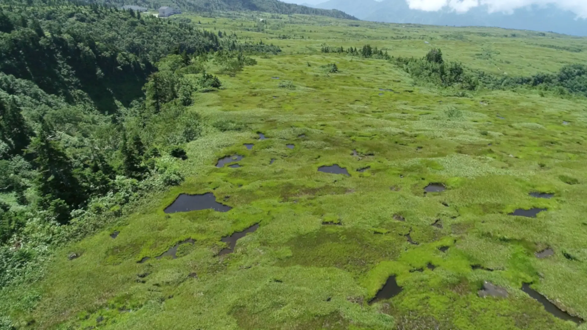
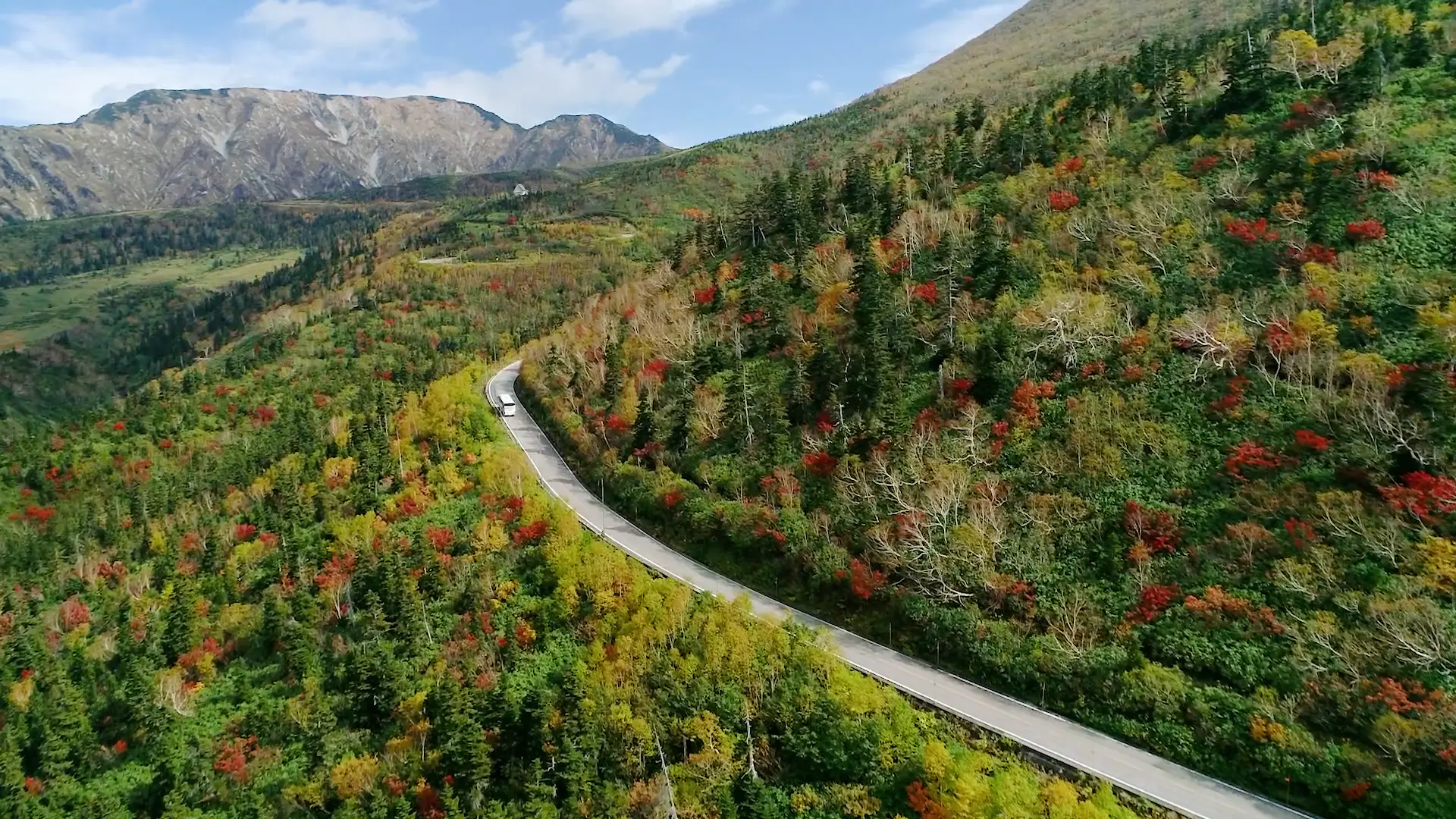
Midagahara is a spot that symbolizes the abundance of water in Mt. Tateyama. This vast wetland, stretching 4 km east to west and 2 km north to south between 1,600 m and 2,000 m above sea level, is the highest Ramsar site in Japan and is internationally very valuable.
In summer, rare alpine plants such as cotton grass and aleutian avens are in full bloom, and in autumn, the vast marshland is colorful with the red of the Japanese rowan and the yellow of the Betula ermanii.
5. 迫力満点!落差日本一の大瀑布「称名滝」
落差日本一の称名滝へは、自家用車か富山地方鉄道立山駅から出ているバスに乗って行きます。
バスから降りて、悪城の壁(称名滝が削ってできた断崖絶壁)の迫力に圧倒されながら遊歩道を30分ほど歩くと、大量の水が流れ落ちる轟音が徐々に大きくなり、まもなく水しぶきとともに称名滝の大瀑布が姿を現します。
立山から流れてくる大量の雪解け水は、弥陀ヶ原を経て、称名滝から一気に流れ落ちます。その落差は350m。水量の多い5月から6月にかけては落差500mのハンノキ滝が現れます。
10万年前は2km下流にあったと言われる称名滝は、今でも岩を削り、毎年10センチずつ後退を続けています。その水量は、多い時で毎秒10トン、ドラム缶50本分に相当します。
称名滝は4段にわかれていて、上から順に70m、58m、96m、4段目だけで日光の華厳の滝より30mも高い126mもあります。
称名滝のもうひとつの見ごろは、紅葉のシーズン。
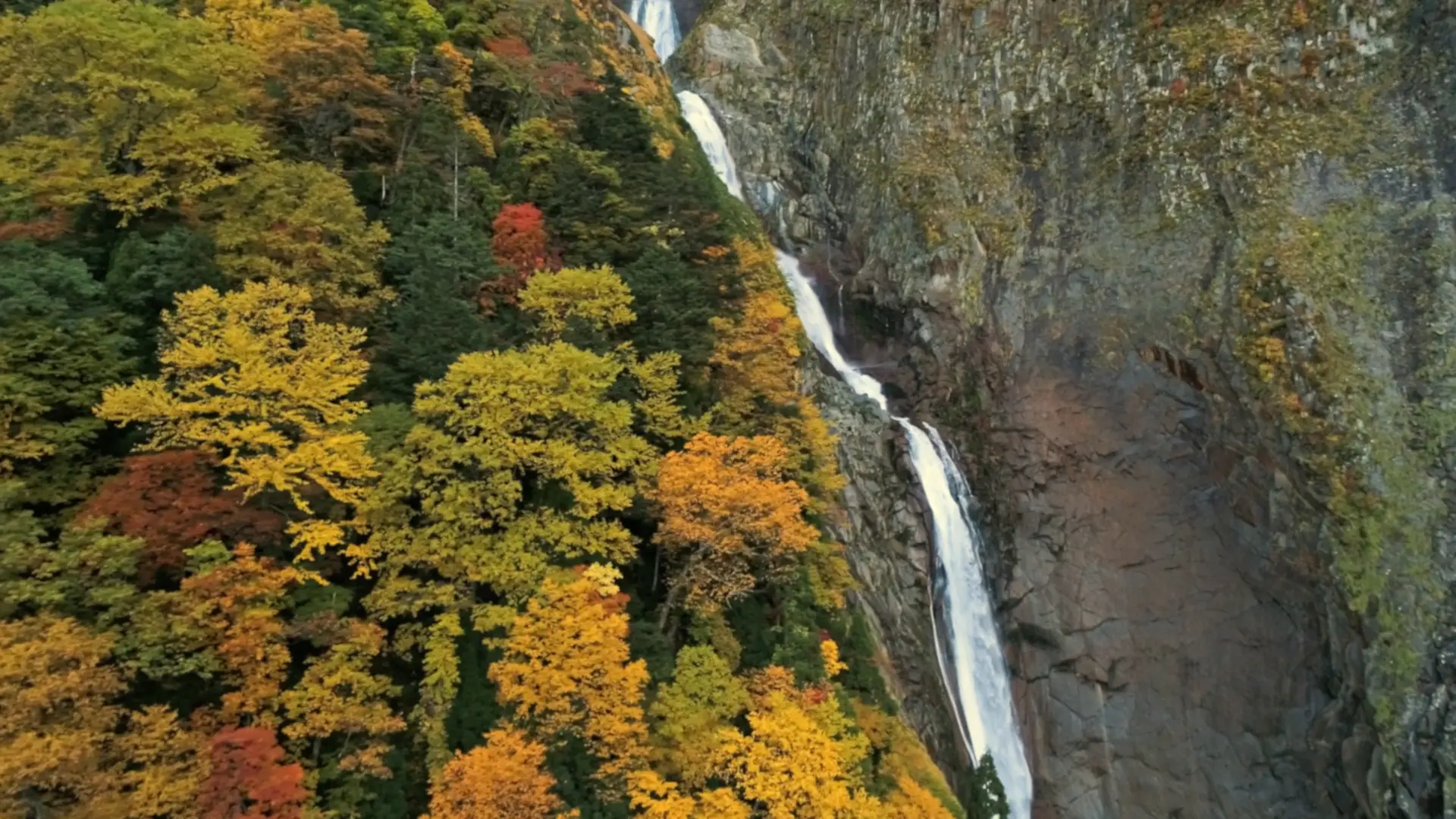
弥陀ヶ原よりも少し遅く、10月下旬にピークを迎えます。急峻に切り立った崖が赤や黄に染まり、迫力ある滝や荒々しい岩肌とのコントラストが壮大な自然美を創り出します。
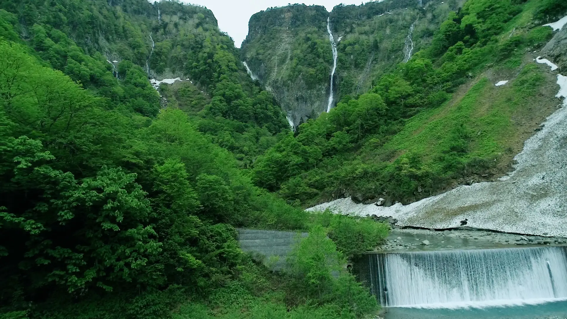
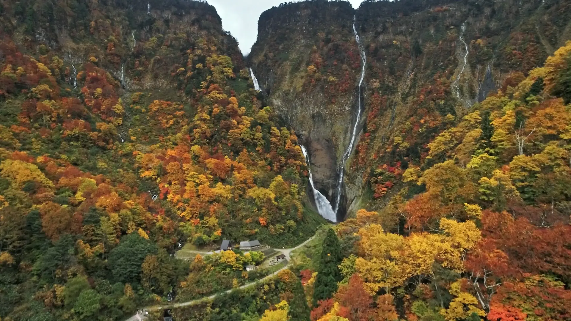
Shomyo Fall is the highest waterfall in Japan. A large amount of melt water from Mt. Tateyama flows down this waterfall after passing through Midagahara. The water drops 350m. From May to June, when there is a lot of melting snow, the 500-meter-high Hannoki Falls appear next to the fall.
Shomyo Falls, which is said to have been 2km downstream 100000years ago, is still carving away at the rocks and receding by 10cm every year.
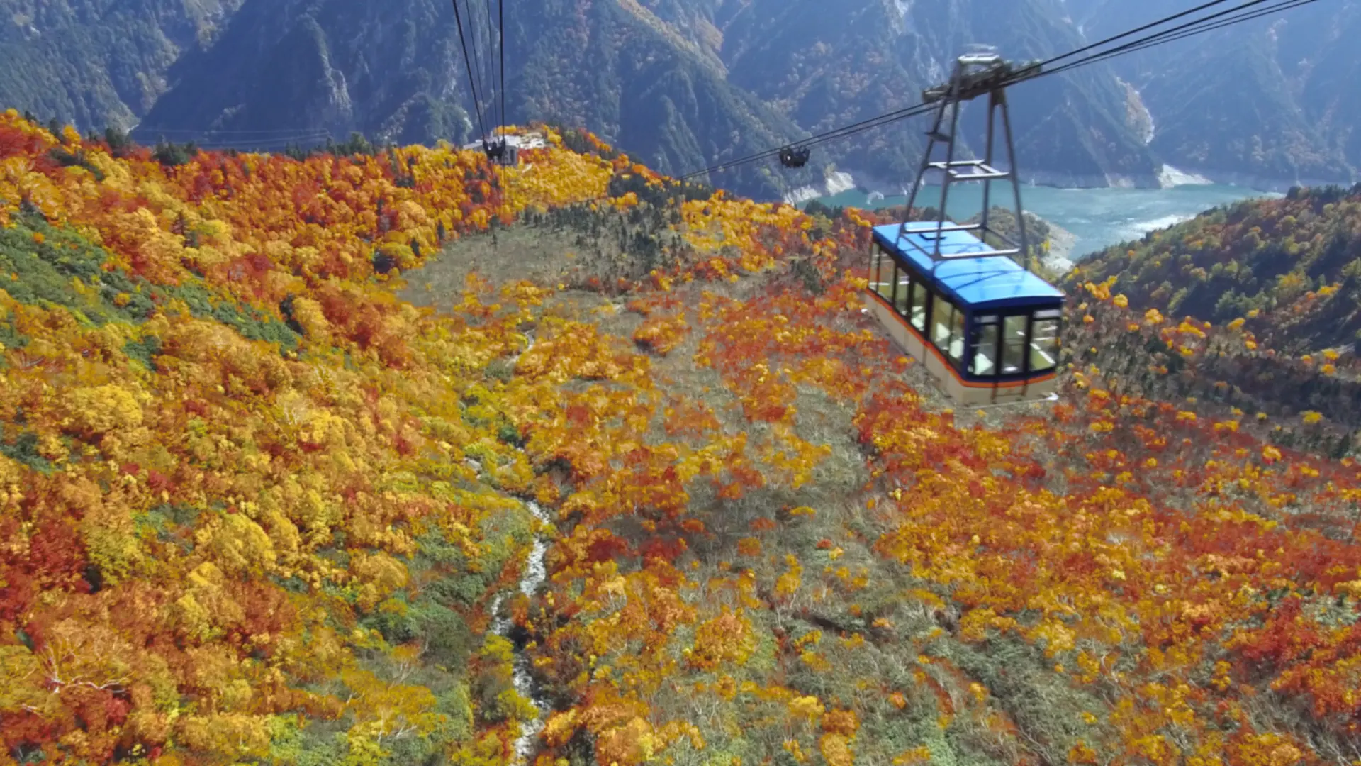
6. 空中散歩で広大な紅葉の絨毯を満喫「タンボ平(立山ロープウェイ)」
室堂ターミナルからトロリーバスに乗り換えて立山の真下をくぐると、標高2316mの大観峰駅に到着します。
大観峰の展望台からは後立山連峰や黒部湖を一望でき、眼下には標高1828mの黒部平まで緩やかな斜面が広がっています。
ここが立山でも1番の紅葉の名所、「タンボ平」です。
紅葉シーズンの9月下旬から10月中旬にかけて、ここは見渡す限りの色鮮やかな紅葉の絨毯となります。
大観峰と黒部平をつなぐ立山ロープウェイからは、この広大な紅葉の絨毯の上を空中散歩するように堪能することができます。
立山ロープウェイは、支柱のない「ワンスパン方式」としては日本一長い約1.7km、高低差488mを約7分かけて走行します。
反対側の長野県大町から入ると、黒部ダムからケーブルカーに乗って黒部平に到着します。
タンボ平は上から見ても下から見てもその広大さに圧倒されます。立山ロープウェイの車両から見上げると、断崖絶壁の途中に建設された大観峰駅の存在感に圧倒され、同時に大自然の壮大さを実感することができます。
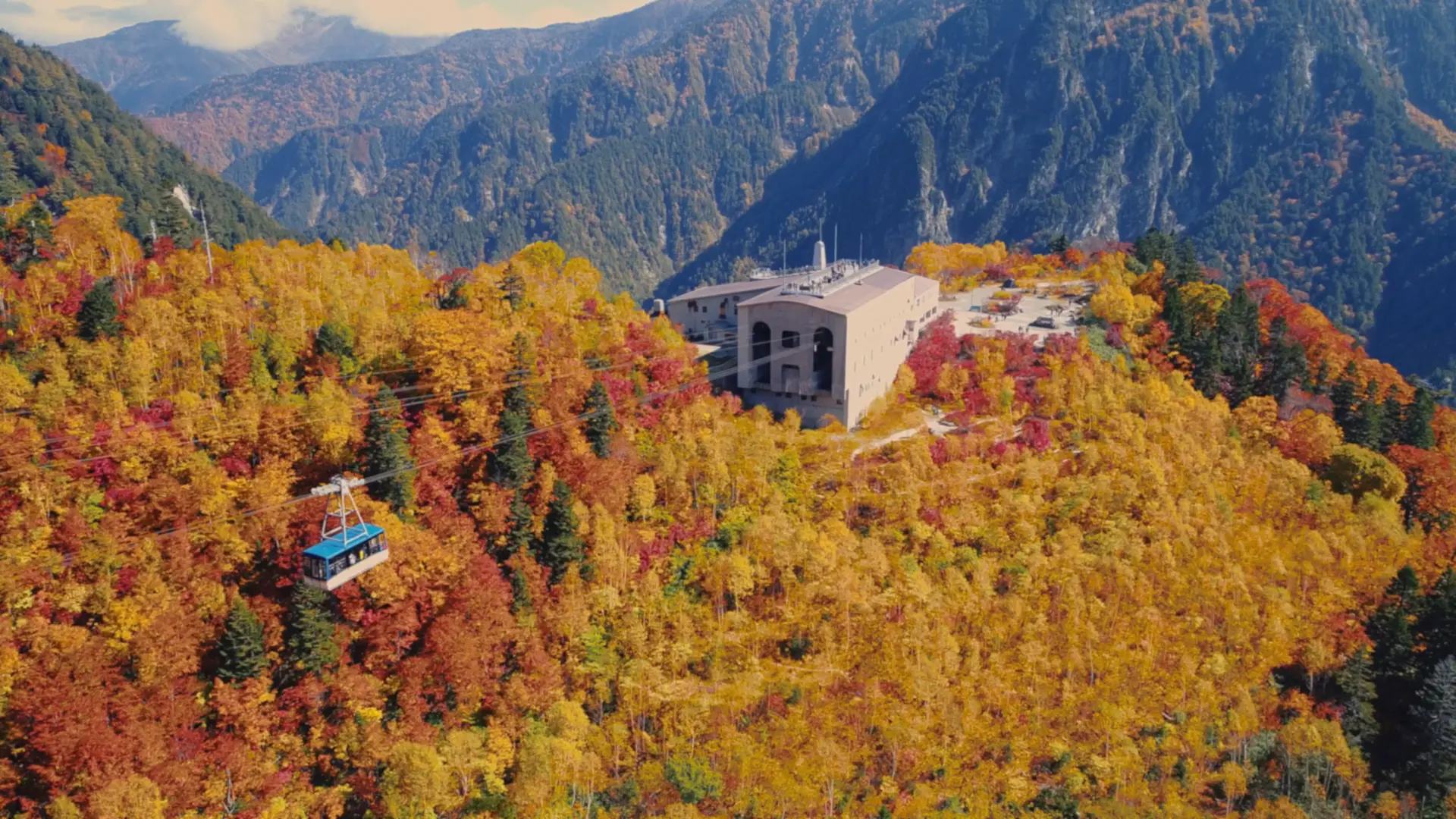
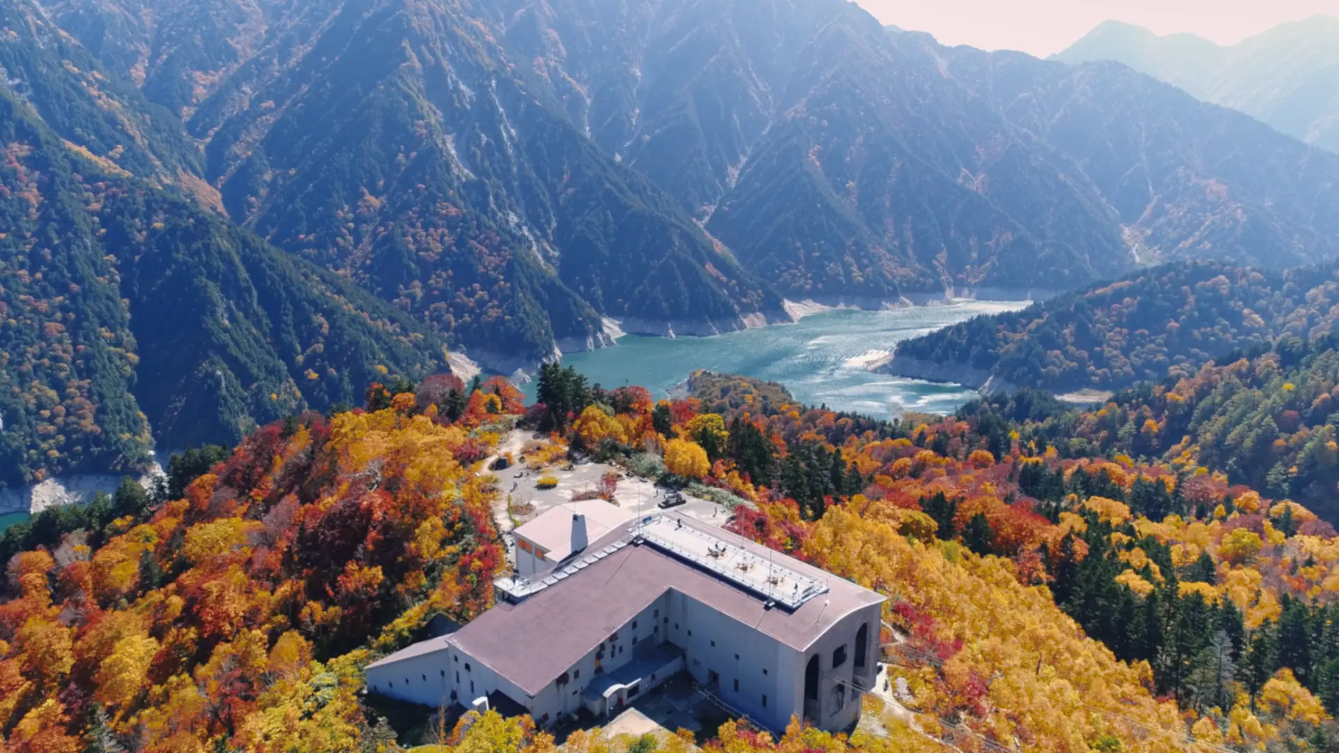
A trolley bus ride from the Murodo Terminal takes you to Daikanbo Station at an elevation of 2,316 meters. From the observatory, you can enjoy a panoramic view of Kurobe Lake and the gentle hill to Kurobedaira below. This is Tambodaira, the most famous place in Tateyama for its autumn foliage.
From the Tateyama Ropeway, which connects Daikanbo and Kurobedaira, visitors can enjoy a walk in the air over this vast carpet of autumn leaves. The Tateyama Ropeway takes about 7 minutes to travel 1.7 km, the longest "one-span" ropeway in Japan without any pillars.
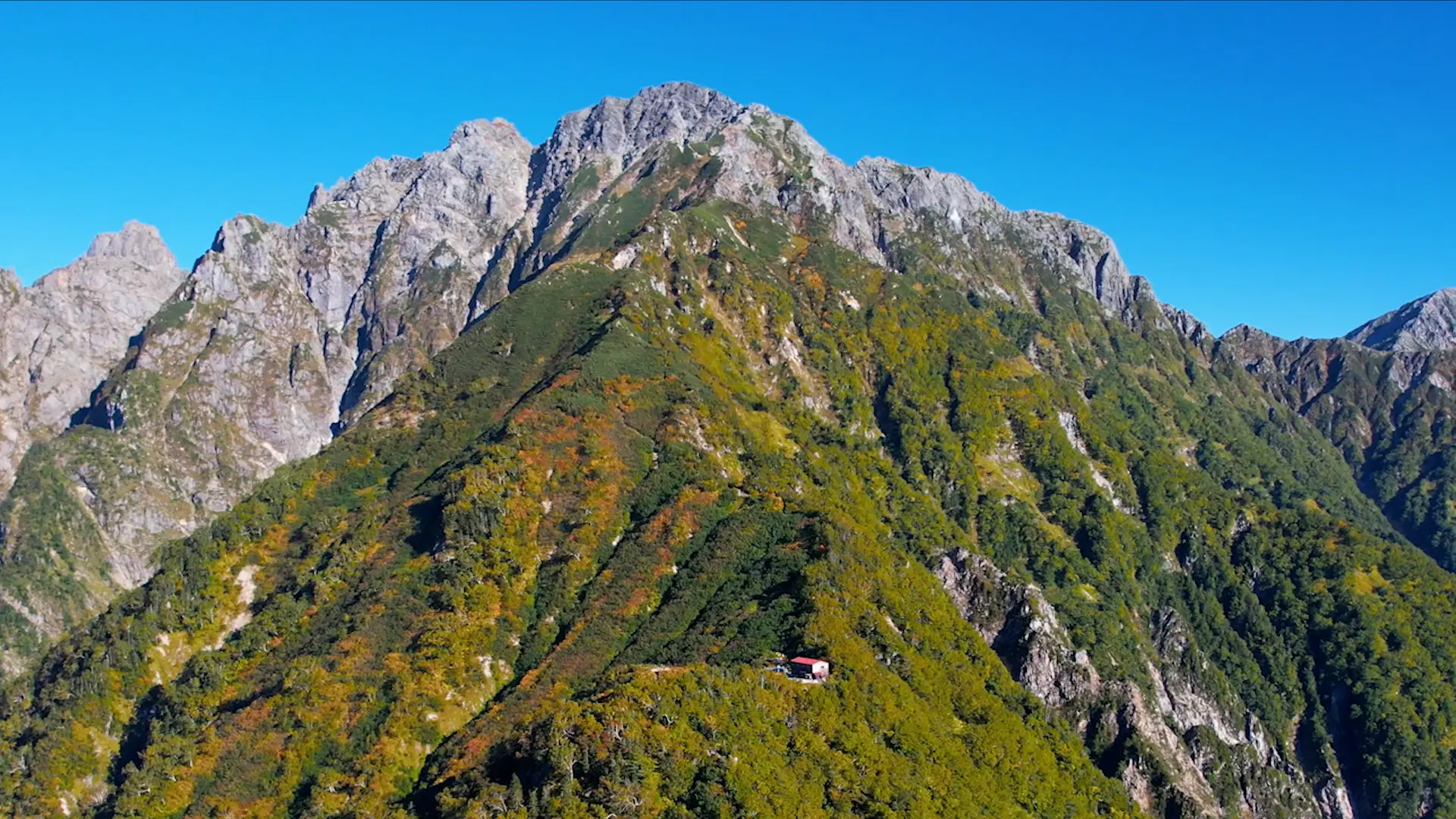
7. 氷河が現存する岩と雪の殿堂「剱岳」
立山登山の中で最も上級者向けなのが、「アルピニストの憧れ」剱岳(標高2,999 m)です。
日本百名山に選出され、氷河の現存する山としても知られています。
岩が氷河に削り取られてできた荒々しい稜線は登山者を圧倒し、「岩と雪の殿堂」とも呼ばれています。
登頂するには「カニのヨコバイ」「カニのタテバイ」といった難所を制覇しなければならないことから、日本国内で「一般登山者が登る山では、最も危険度の高い山」とも言われていますが、鎖やハシゴなどで岩峰を登れるように整備が行き届いているため、登山経験が豊富な人なら十分に登ることができる山でもあります。
難所を乗り越えた先には360度の大パノラマと間近に迫る荒々しい岩山との対比で、まさにここでしか味わえない独特の絶景体験が待っています。
登頂の達成感がひと際高い山でもあります。
剱御前小舎や剣山荘など途中の山小屋で休憩・宿泊しながら、天候や自分の体力に合った計画でトライするのがよいでしょう。
(一般的な別山尾根コースのほか、馬場島から登る上級者向けの早月尾根コースもあります)
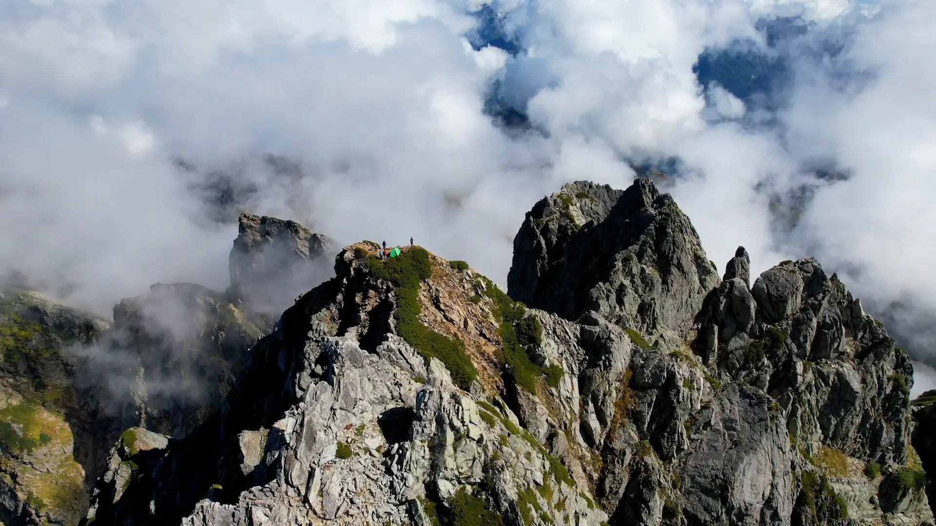
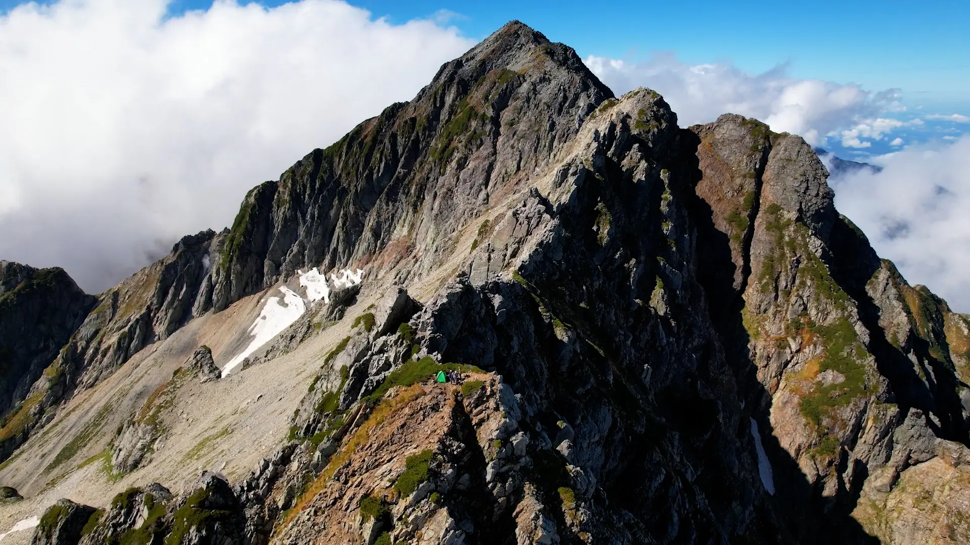
Tsurugidake is 2,999 meters high, one of Japan's 100 most famous mountains, and is also known as a mountain with existing glaciers.
The rugged rock formations carved by glaciers overwhelm climbers, and the mountain is also known as the "Hall of Fame of Rocks and Snow". It is said to be "the most dangerous mountain for ordinary climbers" in Japan, as it requires conquering difficult sections in order to reach the summit.
After overcoming the difficult sections, a 360-degree panoramic view awaits. It is also a mountain where the sense of accomplishment upon reaching the summit is particularly high.